World Wide Maps Samsonvale Bush Walks Map 9443-24
Regular price
$25.50
Regular price
$0.00
Sale price
$25.50
Tax included.
Shipping calculated at checkout.
- Out of stock
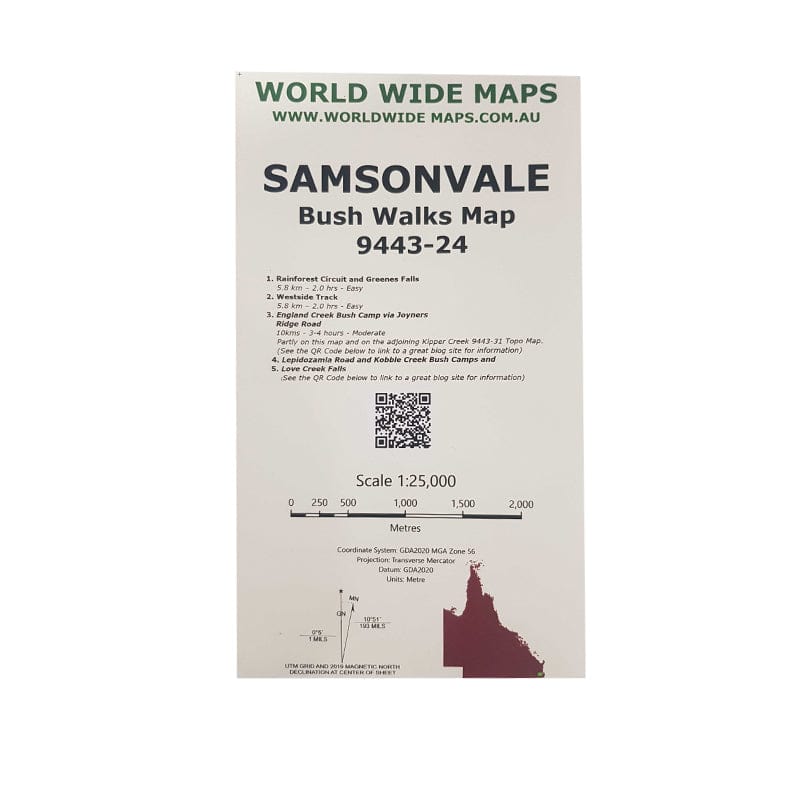
This print on demand 1:25,000 scale topo map Samsonvale 9443-24, replaces the old published map (1981).
The standard topo map has been enhanced by World Wide Maps with 5 bush walks highlighted.
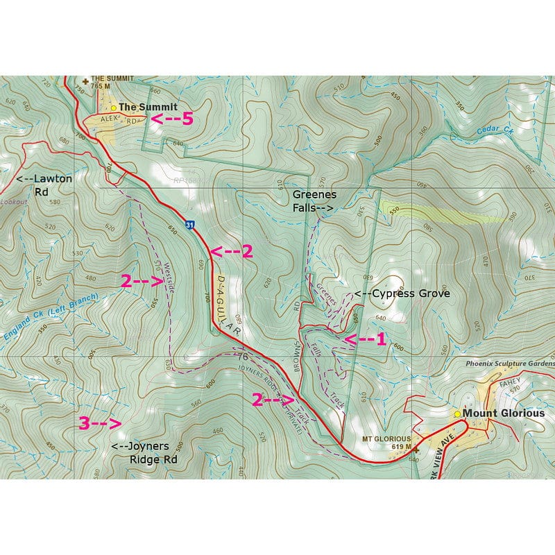
1. Rainforest Circuit and Greenes Falls
2. Westside Track
3. England Creek Bush Camp via Joyners Ridge Road
4. Lepidozamia Road and Kobble Creek Bush Camps
5. Love Creek Falls
The map covers part of South D’aguilar National Park, Brisbane Forest Park.
Close
1 / 2

World Wide Maps Samsonvale Bush Walks Map 9443-24
2 / 2

World Wide Maps Samsonvale Bush Walks Map 9443-24

World Wide Maps Samsonvale Bush Walks Map 9443-24
Regular price
$25.50
Regular price
$0.00
Sale price
$25.50
Recently viewed
World Wide Maps
World Wide Maps Samsonvale Bush Walks Map 9443-24
Regular price
$25.50
Regular price
$0.00
Sale price
$25.50
World Wide Maps
World Wide Maps Samsonvale Bush Walks Map 9443-24
Regular price
$25.50
Regular price
$0.00
Sale price
$25.50
World Wide Maps
World Wide Maps Samsonvale Bush Walks Map 9443-24
Regular price
$25.50
Regular price
$0.00
Sale price
$25.50
World Wide Maps
World Wide Maps Samsonvale Bush Walks Map 9443-24
Regular price
$25.50
Regular price
$0.00
Sale price
$25.50


